January to May 2019
At San Francisco’s Public Libraries
This exhibit is something after my own heart. A WPA map of San Francisco combines my love of the projects that stemmed from the WPA and the history of San Francisco. This exhibit is called Take Part and more information about the locations of the parts of the map can be found here.
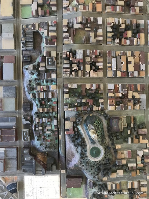
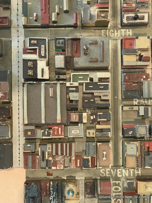
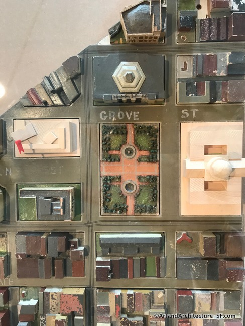
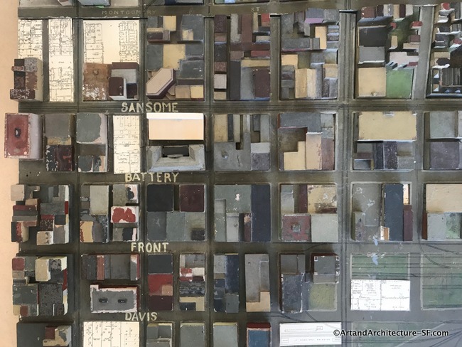
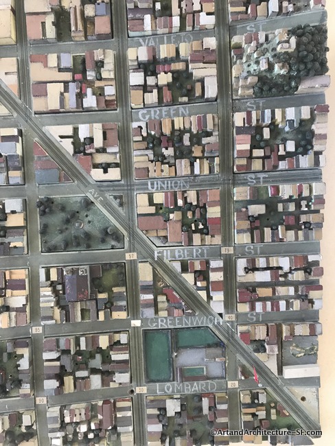
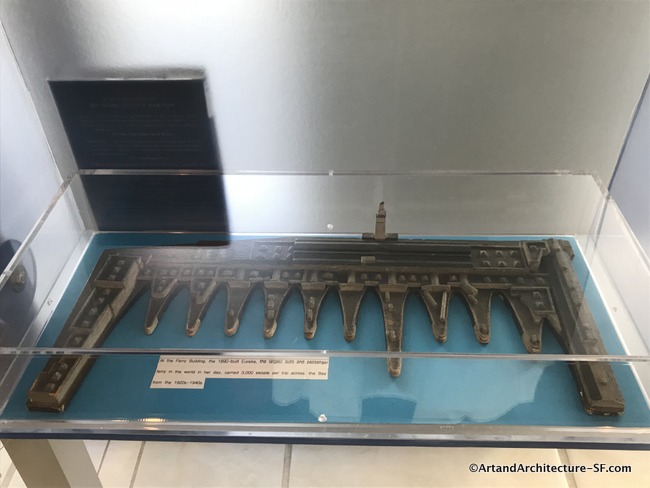
The model is a detailed wooden replica of the city of San Francisco at a scale of one inch to one hundred feet. It was built by the Works Progress Administration (WPA) in the late 1930s, under the New Deal. It shows San Francisco from San Bruno Mountain to Yerba Buena Island to the Presidio.
The original project was the brainchild of San Francisco architect Timothy Pflueger with City Planning Commission sponsoring it. Plans were drawn using aerial photographs and surveys. It was constructed in an unidentified church and took 300 craftspeople two years to build at a cost of $102,750.
There is little known about the historical timeline of the map. The completed model was displayed just once, intact, in the Light Court at City Hall. Then World War II broke out and the Light Court became a war room, so the map was taken apart and put in crates.
It eventually found its way to the College of Environmental Design at UC Berkeley. The model was used as an urban planning tool by the students, and when one examines their neighborhood closely one can see that at times, the map was updated by students and professors at UC. I found several buildings that were from the 1960s.
Eventually, it again saw the light of day when a curator of SFMOMA, who knew of its existence decided to do an educational outreach program called Public Knowledge. That program involved both SFMOMA and the San Francisco public library.
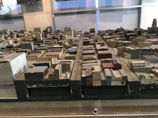
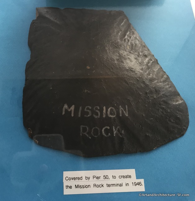
There are some pieces missing, and the group sponsoring this event are hoping people that may know of their whereabouts will come forward with them. Even without the missing pieces, the map is considered to be the largest and most intact of any of a number of city models built across America by the WPA.
Take Part is a collaboration between Dutch, Rotterdam based artists Liesbeth Bik and Jos Van der Pol, and SFMOMA. Working globally in a variety of forms including performance, publications, videos and public projects, the artists explore how “publics” are formed and come together. Several of their projects deal with archives and collections, while others are about particular places and local histories.
Not all the pieces are on display but the ones that are, can be found in branch libraries across the city. However, I recommend you start on the 6th floor of the Main Library as there is an explanation of the map, with historic photos, then venture out to explore the neighborhoods. The project runs through March, after that, it is hoped a home can be found for the entire model.
I will be visiting all the libraries over the next two months and adding photos as I do, so please come back and take a look.
A composite image of the entire map can be found at David Rumsey’s website here.
Here is a link to the aerial photos used for the project, again at the incredible David Rumsey Map Collection.