Grain Silos in San Francisco?

 Posted by on November 6, 2013
Nov 062013
 

696 Amador Street
off 3rd Street / Pier 90/92
Bayview/Hunters Point

Grain Silos in San Francisco

 These abandoned silos on Pier 90/92 formerly stored grain that was brought in by rail and then loaded from the silos onto ships for export. These operations were discontinued following the 1989 Loma Prieta earthquake.

Pier 90/92 was created in 1918 by the State Harbor Commission.  In the 1920’s the grain terminal also had a mill to serve local needs.  The terminal could hold 500,000 bushels, the principal grain that flowed through them was barley.  In the 1970’s the terminal was used to export grains to Russia during their severe drought.

DSC_2345

They are slated to become an art installation soon.

The Pier 92 Grain silo project is being funded through the Port’s Southern Waterfront Beautification funds, a policy established by the Port Commission.

The Port of San Francisco retained the Arts Commission to assist in the commissioning of a public artwork to be located at Pier 92, along San Francisco’s southern waterfront. Four artists/ artist teams were selected as finalists to propose a public artwork for this site that serves as an entrance to the Bayview community: Ball-Nogues Studio; ElectrolandHaddad/Drugan; and Rigo 23.

The committee chose Haddad/Drugan and their “Bayview Rise” Project.  It will be a long-term temporary installation, expected to be in a place for a minimum of 5 years. The artwork will be reversible in that it may be painted over or removed.

Abandoned Grain Silos*

Grain Silos Pier 92 San FranciscoI am not young enough, nor have the physical dexterity to climb over barbed wire fences, however, Joseph Schell does – check out his photographs of the interior of the grain silo structure.

Grain Silos Pier 92 SF

This portion of San Francisco is covered with historic and abandoned buildings.  While the city and the Port of San Francisco is dedicated to keeping the buildings intact and pushing the concept of reuse rather than destruction, only time will tell.

Oslos has already put their grain silos to re-use by putting in dormitories, check it out here.


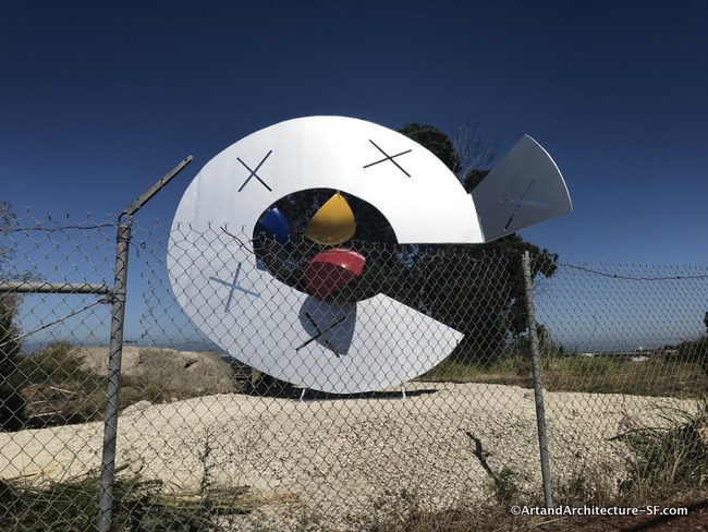
A Start to the Blue Greenway Art Trail

 Posted by on February 27, 2013
Feb 272013
 

Arelious Walker and Innis Street               originally at Cargo at Third Street
Bayview/Hunters Point

The refurbished piece

Red Fish by William Wareham on 3rd Street at Cargo

The original location for Willam Wareham’s Red Fish

This piece is titled Red Fish by William Wareham.  Wareham has several pieces around San Francisco.

The piece was installed as part of San Francisco’s Blue Greenway project.  The Blue Greenway is the City of San Francisco’s Port project to improve the City’s southerly portion of the 500 mile, 9-county, region-wide Bay Trail, as well as the newly established Bay Area Water Trail and associated waterfront open space system.

The alignment of the Blue Greenway generally follows the alignment of the Bay Trail and Bay Area Water Trail from Mission Creek on the north to the County line on the south.

Another component of the Blue Greenway is an Art Trail along the southern waterfront.  The ultimate goal is to establish 8 -10 permanent sites that showcase temporary installation art and the work of local artists.

Red Fish by William Wareham

I found this fun little blurb in a press release from William Wareham:

“On my studio wall is a small sign (the lettering disappearing from age) that says: “Do not be afraid!” Perhaps intended as a morale booster to those WWII sailors going off to war from this shipyard: it now acts as an aesthetic reminder to pursue the creative act with vigor. But what is that? Is it to take three-dimensional form to where it has not been before or mine the turf that others have excavated in the belief of finding new harmonies? Whichever path, to activate space with steel is a challenge. I try to resolve this with both knowledge and intuition asking myself constantly; “Is this solution too predictable?” I rework and change the forms to get a more dynamic relationship, interesting intervals, tension in the negative volumes or contrasting scale; all with the purpose of bringing a great sense of visual delight to our lives.”

Red Fish was installed in 2006 and did not age well.  Red is a difficult color to keep vibrant in any environment, but the rest of the piece is not doing well either.

The San Francisco Art Commission has said that the piece will remain in this location for five years with an option to renew.

Walker is a part of the Hunters Point Neighborhood and worked closely with the Bayview Historic Society, who raised the money for the refurbishment,  to keep the piece in the Bayview Hunters Point area.

Islais: From Creek to Sewer to Creek

 Posted by on February 7, 2013
Feb 072013
 

Islais Creek
Bayview/Hunter’s Point

Islais Creek

It is known as Third and Army by skateboarders. Longshoreman call it Pier 84. Locals just think of it as Islais Creek. No matter its name, it is an area experiencing ongoing urban and environmental renewal.  Islais Creek originally flowed for 3.5 miles from the hills of  San Francisco into the Bay. The area now called Islais Creek Channel is an inlet of San Francisco Bay located in the Central Waterfront area between Potrero Hill and Bayview / Hunters Point. The area was once a vast salt marsh.  Over the course of the 19th and 20th centuries this area of Islais Creek devolved from a habitat teeming with wildlife to an industrial wasteland, until it was finally rescued by environmental, government and neighborhood groups working hand in hand.

skateboarder

Los Islais (is-Lay-is), named for the Hollyleaf Cherry, provided the Ohlone Indians-the first settlers of the area-mussels, clams and shrimp. In the early 1800s the missionaries from Mission Dolores drew their fresh water from the area. Later, the 49ers, coming down from the mountains during the Gold Rush, began settling on its banks, and then the deterioration started. In 1871 over 100 slaughterhouses were situated on the banks of the creek, giving the neighborhood the illustrious name “Butchertown.” After the 1906 earthquake, the city fathers found it a convenient spot to dump earthquake debris. In 1925 the State Legislature created a reclamation district to drain and develop the Islais Creek basin as an industrial area, leaving only a small shipping channel.  Until the 1950s this section of Islais Creek was basically an open sewer.

Islais Creek LandingIn 1970 the City of San Francisco built a water treatment plant along the channel to improve the quality of the water flowing into the Bay.

This same area of Islais Creek, the center of the current urban renewal, is now a channel within a landfill, atop what once was a broad inlet of the bay. Towering over the site of the rebirth is a dynamic structure called a Copra Crane. Copra is dried coconut imported, in those days, from the Philippines. Men would go down into ships’ hulls, alternatively working and resting for 20 minutes at a time. One man would break up the coconuts with a pick, and another would shovel the broken pieces into a pile. Cranes would then suction the pieces out and transport them to a warehouse. From there the meat was sent to a Cargill plant to be made into coconut oil. In the 1960s mechanization came to the waterfront, and the men, their picks and shovels were replaced by a small tractor with mechanical choppers.

Copra CraneCopra cranes performed many functions in the coconut business;  this  particular crane  was used to load onto ships processed pellets that were then sent overseas to be sold.

The 1970s saw the end of the Copra trade and the abandonment of the industrial area known as Pier 84. In the 1980s a large contingency of environmental and neighborhood groups began lobbying for a clean up of the area and the building of a park to increase the open space that was so needed in the Bayview/Hunters Point neighborhood, an area often described  as a marginalized community with modern problems including high rates of unemployment, poverty, crime and disease.

A group of retired and active waterfront building tradesmen also joined the efforts to ensure that the Copra Crane was part of this revitalization. The historic value of the crane was recognized by the Port of San Francisco, and the crane was saved.

Copra CraneIn the Fall of 2011 the crane was removed and restoration began.

As part of the revitalization, the dock that the crane sits upon will be stabilized and the crane put back in its rightful place. The restoration is expected to cost a minimum of $400,000 and take well over a year. The revitalized area already has a small boat dock and sand slide for launching outrigger canoes. Additional plans call for a museum featuring waterfront labor history. The groups that have worked so hard to restore Islais Creek continue to write grants and find ways to bring jobs and public awareness to the area through urban revitalization.  In 2009 Jo Kreiter, an aerial artist, and her troop performed on the crane. It is hoped that more art will be brought to the neighborhood as the popularity of the revitalized area grows.


Islais Creek Promenade


Islais Creek is home to the Liberty Ship Sculpture  by Nobuho Nagasawa  and the Metal Fish  by Todd Martinez and Robin Chiang.

Islais Creek Park

 Posted by on October 4, 2011
Oct 042011
 
Islais Creek Park
Quint, Third and Berry

The Ohlone Indians were harvesting mussels, clams, and shrimp on the shores of Islais Creek long before Europeans arrived in 1769. The creek appeared on Mexican maps in 1834, named for Los Islais (is-lay-is), a hollyleaf cherry and favorite Indian food. On today’s map it is the gateway to (the former) Butchertown, Bayview/Hunters Point neighborhoods.In the 1850s Islais Creek provided fresh water to Franciscan friars from Mission Dolores and irrigated the produce that Portuguese, Italian, and Irish vegetable farmers grew in the Bayview district. The Gold Rush marked the start of the creek’s decline when hordes of forty-niners swarmed out of the city and settled into the makeshift housing on the water’s edge. In 1870, the slaughterhouses of Butchertown came in, and Islais Creek, red with blood and offal, reeking of garbage, sewage, and unfit for any use, was diverted to a culvert and its contents sent out to the Bay.

Until the 1950s, the waterway was an open sewer, known colloquially as “S____ Creek.” Things changed in the 1970s with construction of a water treatment plant nearby and the clearing out of Buchertown’s auto-wrecking yards. But it was not until 1988 when neighbors banned together to create this wonderful little park. Today it is even greater, and bigger than they imagined.

The piece above marks the entry, and yet I could find nothing out about it or its artist. (Read update below)

I have always loved this structure, you see it just before you enter San Francisco coming from the airport. The five-story high copra crane unloaded dried coconut meat at Islais Creek’s copra dock from 1947 to 1974. Rescued as a San Francisco landmark, it will tower over the new promenade slated for this area.

A new note. In November I contacted Robin Chiang, an architect and active participant in the Islais Creek Renovation. He told me this about the sculpture.

The tower in your photograph was rescued from the Granax property on the north side of the channel when SFMTA bought it from the Marcos family (of the Philippines). It was used for hanging hoses. I designed the metal fish with cut out letters and commissioned metal artist Todd Martinez to fabricate and install it. When the SFPUC was expanding its booster pump station (at 3rd & Arthur) they asked us what we wanted. We wanted the expansion to be all glass so people could see the pumps, but that was not allowed for security reasons. So I sketched the marquee that proclaims ISLAIS LANDING and SFPUC had it fabricated for the pump station as a marker for the northern gateway to the Bayview.

error: Content is protected !!