SFMOMA
Mission Branch Library
Noe Valley Library
Eureka Valley Library
This is the second post in a series covering the joint SF Library system and SFMOMA project Take Part showing the map of San Francisco built by the WPA. Click here for Part 1
SFMOMA
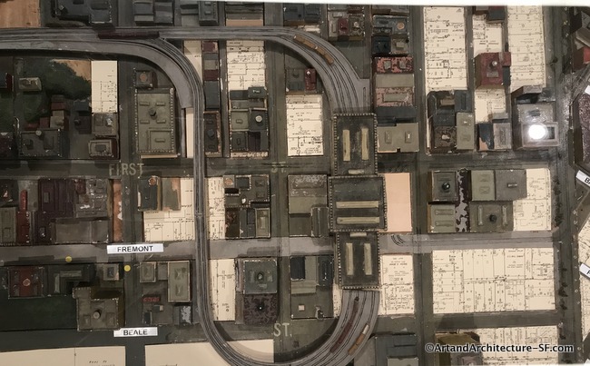
The old Transbay terminal as shown on the map at SFMOMA
The hub of the San Francisco commuter bus and Greyhound system was the old Transbay Terminal. It is shown on the WPA map of San Francisco.
San Francisco’s former Transbay Terminal was built in 1939 at First and Mission Streets as the terminal for East Bay trains using the newly opened Bay Bridge. The Terminal was financed and operated as part of the Bay Bridge and was paid for by Bay Bridge tolls (which were then 50 cents per automobile, or about $7.75 today). At the time, trucks and trains (primarily the Key System) used the lower deck of the Bay Bridge, and automobiles operated in both directions on the upper deck.
Ten car trains arrived every 63.5 seconds. In its heyday at the end of World War II, the terminal’s rail system served 26 million passengers annually. After the war ended and gas rationing was eliminated, the Terminal’s use began to steadily decline to a rate of four to five million people traveling by rail per year. In 1958, the lower deck of the Bay Bridge was converted to automobile traffic only, the Key System was dismantled and by 1959 the Transbay Terminal was converted into a bus-only facility.
A new bus terminal, complete with Public Art has been built. However, due to complications, it was closed soon after its grand opening, and as of this writing (February 5, 2019), it has not yet reopened.
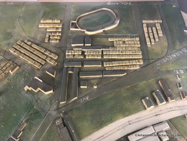
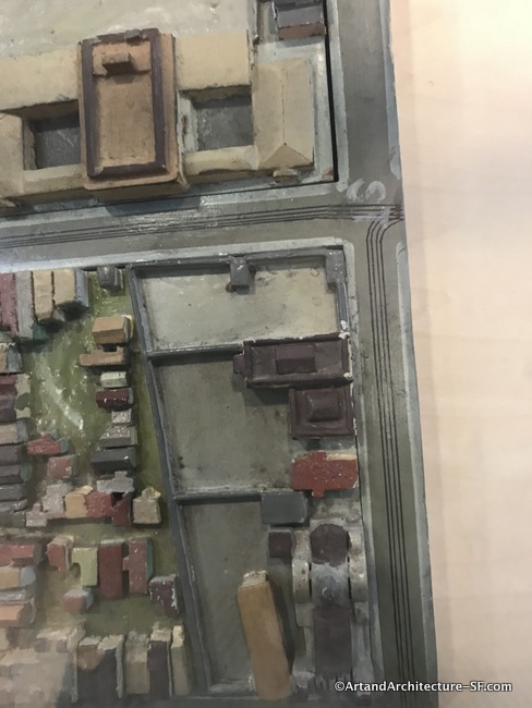
Potrero Hill Branch Library
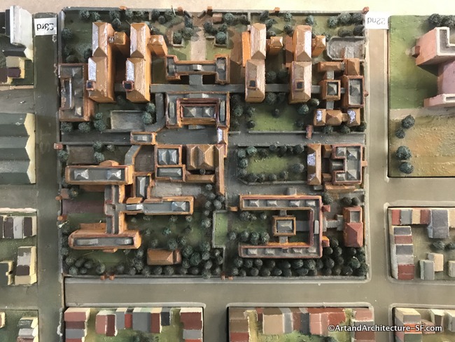
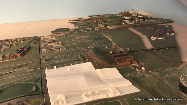
San Francisco General Hospital as portrayed on the map in the Potrero Hill Library
While a hospital sat on this property for years, in 1915 the “New San Francisco General Hospital”, which was a landscaped, red brick, Italian Renaissance style complex, was dedicated during the City’s celebration of the completion of the Panama Canal, at that time motorized ambulances replaced the horse-drawn vans.
One of the map sections at the Potrero Hill Branch Library
The history buff, and someone who has an entire map of San Francisco in his head, my friend Ted, pointed out that the section in the upper right was moved way too far to the right, none-the-less the map of this area shows how the shipyards and PG&E electrical plant were the main items in the area at the time the map was built.
The San Francisco Produce Market as shown at the Potrero Hill Branch Library
I could only find a reference to the stadium on a 1950 Sanborn Map calling it “Formerly San Francisco Stadium – removed”. (volume 11 – page 786)
Mission District Public Library
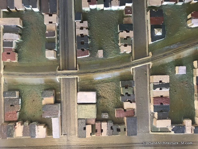
The old San Francisco and San Jose Railroad with its raised beds and bridges as shown on the Mission Branch library section
One of the more interesting things on the Mission Branch library map is the section that shows how the San Francisco/San Jose Railroad (1860s) line actually came through this part of town on raised beds and large bridges where it crossed street intersections. Here is a fun documentary made by CalTrain about the history of the line.
Notice the light wells that abound on the homes that sit wall to wall in the Mission District
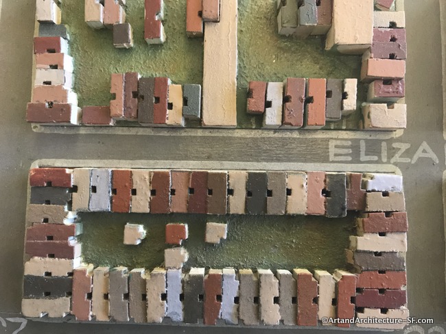
Eureka Valley/Harvey Milk Branch Library
Mission Dolores, the light brown building center bottom, can be found at the Eureka Valley Branch Library
The Eureka Valley section shows primarily the residential neighborhoods, but one interesting building was the German Hospital that sits in the block made up of Noe/Duboce/ Castro and 14th.
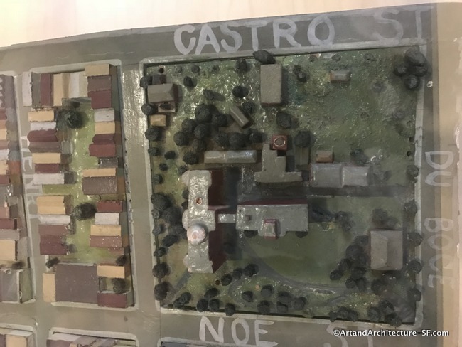
The German Hospital
In 1854, the German General Benevolent Society formed the German Hospital to provide healthcare, food, and shelter for San Francisco’s German immigrants, who flooded the City during the Gold Rush. Founder Joseph N. Rausch, M.D., also proposed one of the country’s first pre-paid health plans: for a dollar a month, German-speaking immigrants qualified for a private hospital bed if they ever needed it, at a rate of one dollar per day. In 1895, the Society expanded its membership and was treating all citizens of San Francisco by century’s end.
If you have the chance, please try to visit this project, it is up until March. It is a wonderful view of San Francisco long ago.
If you do, the Librarians have stamps to prove you have been there, so grab a “Take Part” map at your local branch, collect all the stamps when visiting SFPL branches, and return your completed stamped map to win a SFMOMA prize.